

Everyday experimental marine research needs a greater volume of environmental data with better resolution than what can be collected using oceanographic vessels, buoys, or sensors deployed on the seabed. The seafloor observatories can acquire data with great resolution uninterruptedly during long time periods. With this information, scientific community is able to analyze as well annual tendencies as singular events.
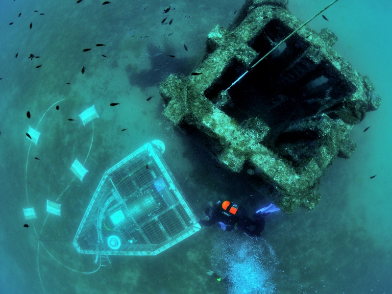
The OBSEA underwater observatory (www.obsea.es) is connected with 4 km of cable to the coast of Vilanova i la Geltrú (Barcelona, Spain) and placed at a depth of 20 meters in a fishing protected area.
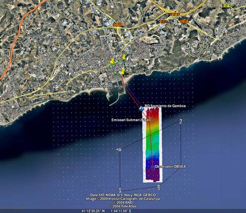
The main advantage of the cabled observatory is the capacity to feed the station from land with up to 3.6kW and the high bandwidth communication link of 1 Gbps. This link gives the information in real time and avoids the drawbacks of battery powered systems. The implemented solution is an optical ethernet network that continuously transmits data from the connected oceanographic instruments. With OBSEA we can observe in real-time multiple parameters of the marine environment. The Ground Station provides power to feed all the devices and the fiber optic link to establish communications. At the same time from land we manage alarms and data storage. With a length of 1000 meters the terrestrial cable connects the Ground Station to the Beach Manhole where the submarine cable begins its route to the node location at 4 km from the coast and 20 meters deep.
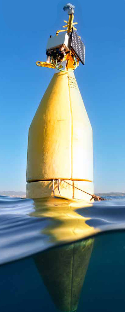
The buoy is an extension of the OBSEA observatory that works as surface platform for measuring oceanographic and environmental parameters. In addition it is also a test bed for sensors and oceanographic equipment that takes advantage of the OBSEA infrastructure and connectivity. The buoy is located at 40m from the underwater observatory OBSEA, and is subjected to three anchors of 1200 kg that are attached to the buoy with chains. The communication links between the ground station and the buoy are done via a wireless 3G connection and through a cable connected to the observatory. The SARTI buoy facilitates to obtain oceanographic remote measurements using the telemetry system and a set of sensors. The electronic system is flexible and allows increasing or replacing the types of instruments and sensors installed. Currently the buoy is equipped with a weather station that measures wind speed, air temperature and atmospheric pressure as well as GPS position, orientation and pitch and roll movements. Furthermore, it has an IP video camera providing images of the buoy and the Vilanova coast.